The more outstanding activities of the group deal with the studies of ecophysiological mechanisms linked to carbon, water and nutrients in the plant species, the development of remote sensing techniques to assess plant and ecosystem functioning, and the report of current evidences of the effects of global change climate and air pollution on the structure and functioning of the ecosystems and the biosphere.
Recent subjects of study are: global change, climate change, atmospheric pollution, biogenic Volatile Organic Compounds emissions, remote sensing, plant ecophysiology, functioning and structure of terrestrial plants and ecosystems, chemical ecology and metabolomics, macroecology and biogeochemistry
Research experimental sites
| Location | Picture | Description |
|---|---|---|
| Meranges |  300px" /> 300px" /> |
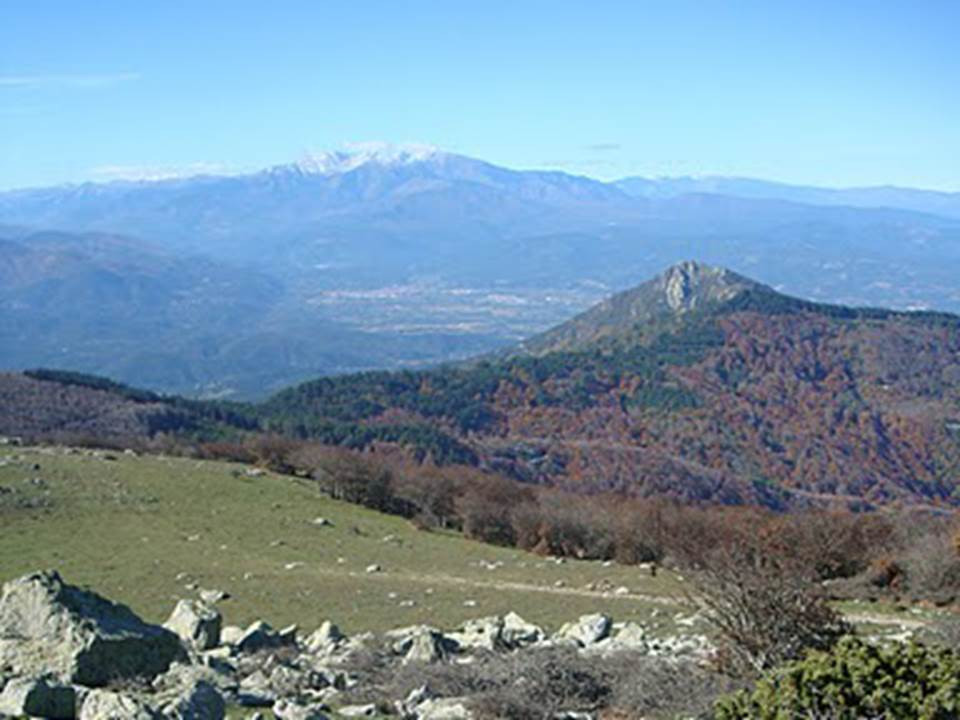
In Meranges area, the Global Ecology Unit studies the effect of climate change and ozone concentration in the Pinus uncinata forest. It is located along the southern and southeastern faces of Puigpedrós mountain (Bellver de Cerdanya 42 ° 22 'N 1 º 46' E in the Central Pyrenees) at a range of 1040 and 2400 m.a.s.l. Thirteen sampling sites were established approximately every 200 meters in altitude in the forest areas dominated by this species. The Global Ecology Unit has been measured the relationship of ozone mixing and its phytotoxicity, as well as the NO2 and VOCs mixture relations since 2004. These measurements are performed every two weeks during each year using passive samplers. Other techniques such as remote sensing and ecophysiological measurements are used to check the status of the forests. |
| Alberes |  |
In The Alberes, the last eastern Pyrenees mountains before reaching the Mediterranean Sea, the Global Ecology Unit study the Mediterranean shrublands, forests of oaks and beech highlights areas of the mountains. |
| Montseny |  300px" /> 300px" /> |
The Montseny Biosphere Reserve (UNESCO 1978) and Natural National Park (since 1987) is the site of some experimental and monitoring ecosystem studies of the Global Ecology Unit. The Montseny massif is a mosaic of Mediterranean and central-european landscapes. It is located in the boundary between the Vallès Oriental, La Selva and Osona regions (longitude 2° 16’ to 2° 33' E and latitude 41º 42’ to 41º 51' N). The area has special microclimatic conditions and contains extraordinary variety of habitats due to differences in altitude and climate (humidity and temperature). The plant communities range from typically Mediterranean to sub alpine. In the lower altitudes holm oak (Quercus ilex) is abundant together with other Mediterranean elements such as cork oak and pines. At higher altitudes the community is a mountain oak forest, in the Central-European environments (above 1000 m) there are beech and fir forests, and subalpine habitats characterized by grasslands and shrublands at the top of the mountains. The climate at high altitudes (from 1000 up to 1700 m) is temperate. The annual rainfall is about 1000 mm and mean annual temperature is about 7ºC at the top of the mountains. One of the most relevant studies conducted in Montseny is the 13C analysis of the tree-rings in beech (Fagus sylvatica). |
| Collserola |  300px" /> 300px" /> |
In Collserola Natural Park, closely near to Barcelona (Central Catalonia, North-east Spain 41º 27' N, 2º 7' E), there is another area about 350 meters in altitude, where the Global Ecology Unit carries out its monitoring and experimental studies. This area contains a wide range of Mediterranean natural environments, predominantly forests. The dominant species, typically about one and three meters tall, are Arbutus unedo L., Bupleurum fruticosum L., Cistus albidus L., Erica arborea L., Pinus halepensis L., Quercus coccifera L. and Quercus ilex. The climate in this area is typically Mediterranean, with cold winters and hot and dry summers, the mean annual temperature is 14.5 ºC and the mean annual rainfall is 610 mm. |
Campus UAB |
 300px" /> 300px" /> |
In the experimental fields of the Universitat Autònoma de Barcelona (Bellaterra Campus, Catalonia, North-eastern Spain), the Global Ecology Unit also carries out its monitoring and experimental studies. |
| Garraf |  300px" /> 300px" /> |
The Global Ecology Unit also leads its experimental and monitoring studies in the Garraf Natural Park (41º 18´ 8´´ N, 1º 49´ E), an area characterized by a dense scrub vegetation. The Garraf mountains are a calcareous formation located about 35 km south of Barcelona (Catalonia, North-east Spain). These mountains constitute one of the most important karstic areas highlighted in Catalonia. Its altitude and location near the coast determines a typical Mediterranean climate: rainfall in spring and autumn (scarce but torrential rain) and mild temperatures, temperate winters and hot and dry summers. The hydrology of the area is conditioned by the karst massif morphology. Thus, the drainage basin is defined by surface water (virtually nil) and groundwater. And the high permeability in the zone involves a high degree of water loss that is not available for plants. The soils are very thin and discontinuous in Garraf. In order to ensure a continuous surface soil under the roots, VULCAN plots are located in abandoned fields that were cultivated until late nineteenth century. This site suffered major fires during summer in 1982 and 1994. Actually, the regeneration of vegetation covers 50-60% of the plot surface with a maximum of 70 cm in height. The main plants in the plots are Erica multiflora and Globularia alypum, with important presence of other species such as Pistacia lentiscus, Ulex parviflorus, Dorycnium pentaphyllum, Fumana ericoides, Helianthemum syriacum, and Brachypodium phoenicoides Ampelodesmus mauritanica. The mean annual temperature is 14.5ºC (7ºC in January and 22°C in July) and the average annual rainfall is 575 mm. The soil type is calcareous and N deposition is about 10 kg N/ha/year. |
| Prades |  300px" /> 300px" /> |
The Global Ecology Unit carried out experimental and control field studies in an oak forest situated in the south-facing slope (25% slope) in Prades mountains (Southern of Catalonia, 41º 20 N, 1º 2´ 4´´ E) at 950 m.a.s.l. The soil is a stony Xerochrept on a bedrock of metamorphic sandstone and its depth ranges between 35 and 90 cm. Mean annual temperature is 12º C and average annual rainfall is 658 mm. Summer drought is pronounced and lasts from mid June to mid September. The oak forest is very dense (16 616 stems ha-1) and is dominated by Quercus ilex L. (8633 stems ha-1), Phillyrea latifolia L. (3600 stems ha-1) and Arbutus unedo L. (2200 stems ha-1) with abundant presence of other evergreen species well adapted to dry conditions (Erica arborea L., Juniperus oxycedrus L., Cistus albidus L.), and occasional individuals of deciduous species (Sorbus torminalis (L.) Crantz and Acer monspessulanum L.). |
Province of Toledo |
 300px" /> 300px" /> |
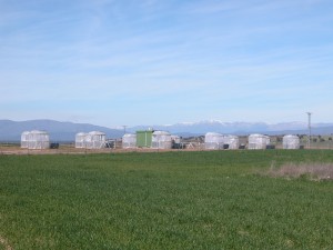
Experiment site in the province of Toledo CIEMAT Open top chambers, analyses the effects of O3 and N on gas exchange and terpene emissions on two leguminous species, Ornithopus compressus and Trifolium striatum, with the aim of better understanding the response of Mediterranean pastures to O3 and N. We intended to gain an understanding of the response of VOC emissions. |

